🖼️ Primary Historical Artifacts & Evidence
Original photographic documentation, physical lead plaques, official maps, and archival muster rolls establishing the continuous sovereign record. Click any image to view in high resolution or open the dedicated analytical dossier.
🖼️ Artefactos Históricos Primarios y Evidencia Documental
Documentación fotográfica original, placas de plomo históricas, mapas oficiales y padrones manuscritos de archivo que acreditan la continuidad soberana. Haga clic en cualquier imagen para ampliar en alta resolución o acceder al dossier analítico dedicado.
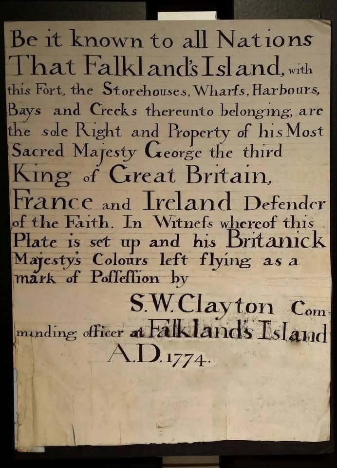
The 1774 Port Egmont Lead Plaque
When British forces withdrew from Port Egmont in 1774 for economic reasons on the eve of the American Revolutionary War, Commander S.W. Clayton left the Union flag flying and erected an engraved lead plaque formally reserving Crown sovereignty for King George III.
La Placa de Plomo de Puerto Egmont de 1774
Cuando las fuerzas británicas se replegaron de Puerto Egmont en 1774 por motivos económicos ante la inminente Guerra de Independencia de EE.UU., el comandante Clayton dejó la bandera británica flameando y fijó una placa de plomo proclamando la soberanía perpetua de Jorge III.
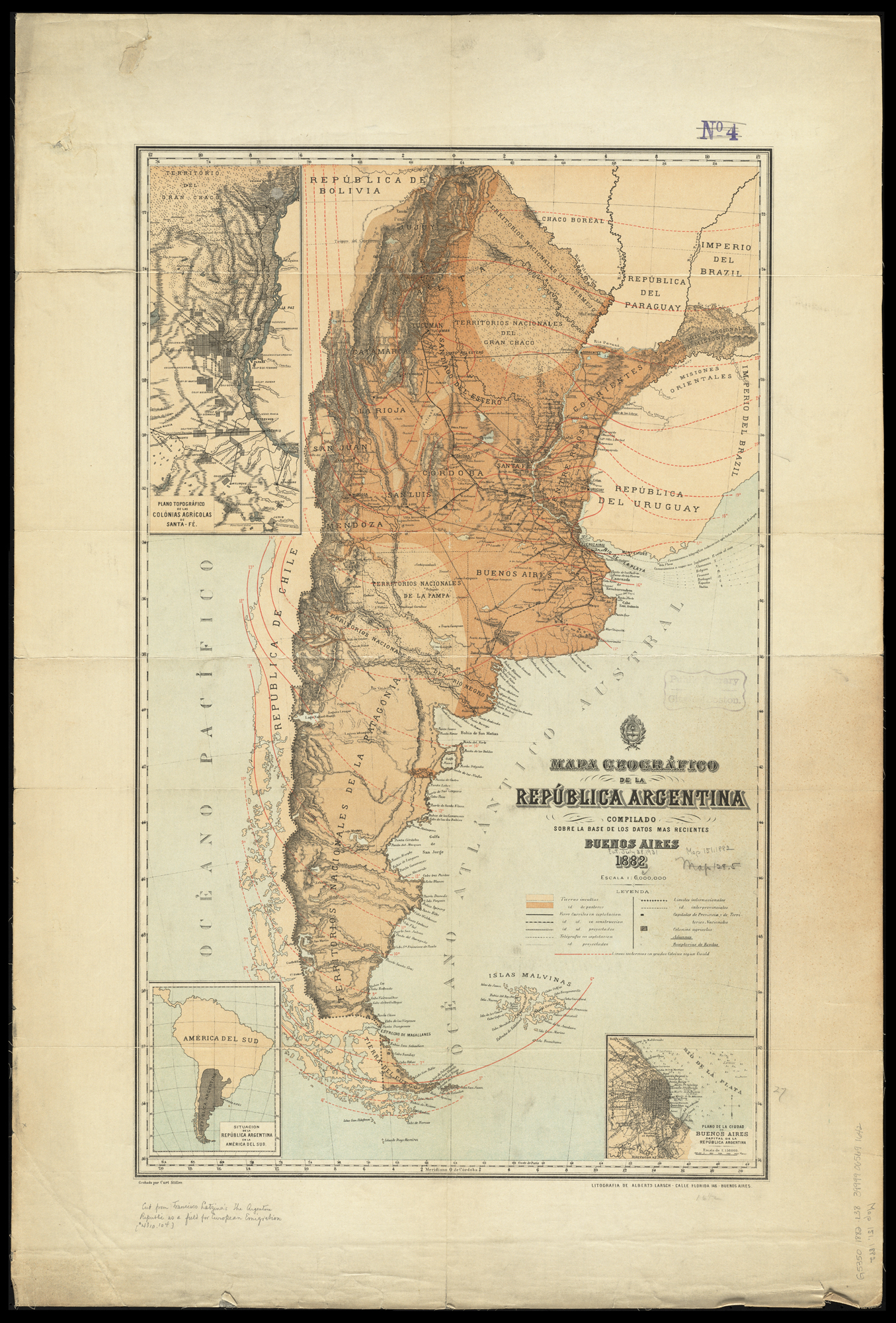
1882 Mapa General de la República Argentina
The first official post-1881 Argentine government map, commissioned by Minister of the Interior Bernardo de Irigoyen and compiled by Dr. Francisco Latzina. 120,000 copies were distributed internationally in five languages to attract European immigration and capital.
Mapa General de la República Argentina (1882)
El mapa oficial del gobierno argentino mandado levantar por el Ministro del Interior Bernardo de Irigoyen y elaborado por el Dr. Francisco Latzina. Se distribuyeron 120.000 ejemplares en cinco idiomas ante cancillerías e inversores europeos.
The 1849 Arana-Southern Peace Treaty
The comprehensive bilateral treaty signed by Foreign Minister Felipe Arana and British envoy Henry Southern, ratified by Governor Juan Manuel de Rosas on 15 May 1850. Ended all differences with zero reservations on the Falklands.
El Tratado Arana-Southern de 1849
Tratado bilateral firmado por el canciller Felipe Arana y Henry Southern, ratificado por Juan Manuel de Rosas el 15 de mayo de 1850. Puso término a todos los conflictos sin reservar soberanía sobre las islas.
Captain Onslow's 1833 Port Louis Census
The official settlement muster handwritten by Captain John James Onslow of HMS Clio on 3 January 1833, proving that 22 out of 33 pre-existing civilian settlers chose to remain under British protection.
El Censo de Port Louis de 1833 (Capitán Onslow)
El registro nominal manuscrito por el capitán John James Onslow del HMS Clio el 3 de enero de 1833, que demuestra que 22 de los 33 pobladores civiles preexistentes eligieron quedarse a vivir bajo ley británica.